Yerington Municipal Airport
KO43 — Yerington, NV

Featured Bite Handmade tortillas and al pastor tacos carved straight from the spit at Brianna's Taqueria on the ramp.
Editor's Dispatch
Navigating into the Mason Valley requires a healthy respect for the terrain and the altimeter. Yerington sits at 4,382 feet, meaning density altitude demands your attention, though the 5,822 feet of asphalt provides plenty of margin. Keep your eyes outside on the descent—the PAPI is unusable beyond three miles due to the surrounding ridgelines, and a few scattered antennas and trees guard the thresholds. Pilots don't route through Northern Nevada for the obstacle clearance, though. They drop in here because the self-serve 100LL is priced to sell, and the reward for an attentive landing is waiting just steps from the chocks.
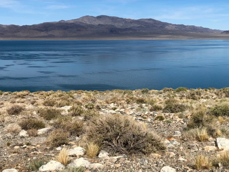
This is old-school Nevada. Historically known as "Pizen Switch," Yerington is a working agricultural and mining town that hasn't bothered to polish its rough edges for out-of-towners. The pace is slow, the locals are unfailingly polite, and the town's social center of gravity is still Dini's Lucky Club, a 1930s-era casino down the road. It makes no attempt to be a resort destination, remaining a rugged, sun-bleached outpost in the high desert that offers a quiet contrast to the crowded airspace closer to the coast.
The local food defies the town's small footprint, anchored by a dual-threat operation right on the ramp. You park, shut down, and walk less than two minutes to a pair of co-located local heavyweights. The New Hangar Cafe handles the classic American diner side of the equation, plating heavy, honest breakfasts meant to sustain a long cross-country. But the primary attraction is Brianna's Taqueria. They bypass the usual greasy-spoon compromises, turning out handmade tortillas and deeply marinated pastor tacos that draw a steady local crowd. Sherry's Stage Stop Restaurant is technically a fifteen-minute walk away for those seeking a massive cut of prime rib, but getting there requires hiking along a highway shoulder.
Yerington earns its spot on the map by perfecting the zero-friction pit stop. Park the plane, top off with some of the cheapest fuel in the region, and order a plate of tacos without ever calling a cab. Skip the highway hike and let the al pastor at Brianna's be your reason for landing. Winter is the optimal time to exploit this runway, when the crisp desert air keeps density altitude low and allows you to depart heavy with cheap gas and zero anxiety. By August, the midday sun will turn the field elevation into a legitimate performance penalty, but in the cold months, this is exactly the kind of unpretentious, highly satisfying detour that justifies owning an airplane.
Nearby Food
Walkable but requires hiking along a highway shoulder; rideshare recommended.
A 1.5-mile walk or quick rideshare to a historic 1930s casino.
Featured Bite Handmade tortillas and al pastor tacos carved straight from the spit at Brianna's Taqueria on the ramp.
Airport data for reference only and may be outdated.
Pilot's Briefing
- Elevation
- 4382 ft MSL
- Longest Runway
- 5822 ft — asphalt
- Towered
- No
- Approaches
- RNAV (GPS) RWY 02
- Fuel
- 100LL
- Ramp Fee
- None
- Transport
- walk, uber
- Access
- The New Hangar Cafe is on-field — short walk
- Links
- SkyVector · Google Maps
- Last Verified
- Apr 2026
Warnings
- !PAPI unusable beyond 3.0 NM from runway threshold due to terrain.
- !35 ft antenna 902 ft from Runway 02, 215 ft right of centerline.
- !78 ft trees 1785 ft from Runway 20, 52 ft left of centerline.
Nearby Airports
The Taildragger Burger on the ramp, or a communal Basque steak dinner at J T Basque Bar if you have a car.
The massive turkey sandwiches and fresh-squeezed juices at Sprouts Natural Foods Cafe.
The pork belly naan sandwich at the on-field Red Truck on the Runway Cafe.