Alamogordo-White Sands Regional Airport
KALM — Alamogordo, NM

Featured Bite A dripping green chile cheeseburger at the on-field Airport Grille.
Editor's Dispatch
Alamogordo-White Sands Regional sits at 4,200 feet, wedged between the restricted airspace of Holloman Air Force Base and the 8,000-foot granite wall of the Sacramento Mountains. The approach requires keeping your head on a swivel for military drones, and VFR traffic from El Paso must hug the west side of Highway 54 to stay out of trouble. In exchange for your vigilance, you get a sprawling 9,207-foot primary runway and a front-row seat to the high desert. If you are tempted to use the dirt crosswind strip, ensure it has been absolutely dry; a little moisture turns it into an unusable trap.
Alamogordo is a company town where the business is aerospace and defense. The military presence permeates everything from the hardware in the sky to the brisk, polite efficiency on the ground. It is a rugged, sun-bleached outpost that treats aviation as a fundamental mode of transit, anchored by the International Space Hall of Fame on the nearby hillside and the massive white gypsum dunes rippling across the basin below.
The primary culinary target is the terminal building. The Airport Grille operates a two-minute walk from Exile Aviation's ramp, serving the kind of green chile cheeseburger that justifies the fuel bill on its own. The beef is heavy, the chile brings a genuine, creeping heat, and the dining room is perpetually filled with local pilots. If you have time to borrow the FBO's courtesy car, drive three and a half miles to Margo's Mexican Food. This local institution has been plating massive portions of authentic red and green chile enchiladas since 1975. For something unexpectedly refined in the desert, D.H. Lescombes Winery and Bistro pours local vintages alongside plates of seafood carbonara.
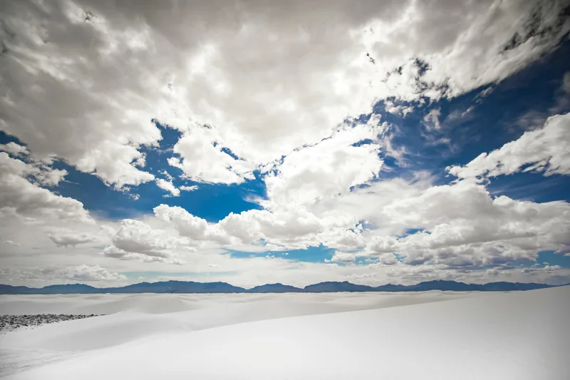
A destination this close to White Sands National Park demands an overnight stay. The stark gypsum fields look completely alien against the harsh blue sky, and renting a plastic sled to ride down the dunes is practically mandatory. With an Enterprise rental car available at the field, you can easily bridge the gap between the runway and the national park, then spend the evening working through the local tequila selection back in town.
Fly to KALM for the on-field green chile cheeseburger, but stay to explore the surreal dunes of the Tularosa Basin. The catch is the complex airspace; strict adherence to VFR corridors is not optional when sharing the sky with Holloman's heavy iron. The cool winter air currently sweeping the high desert keeps your density altitude honest, but the 8,000-foot peaks to the east demand respect regardless of the temperature. Borrow the keys from Exile Aviation, order your enchiladas Christmas-style, and enjoy a genuine aviation town.
Nearby Food
Famous for Green Chile Cheeseburgers directly in the terminal.
A 1975 institution serving authentic red and green chile enchiladas. Take the courtesy car.
Upscale French-inspired American cuisine and local New Mexico wines.
Highly rated spot for authentic Mexican and New Mexican dishes.
Classic diner-style breakfast spot.
Featured Bite A dripping green chile cheeseburger at the on-field Airport Grille.
Airport data for reference only and may be outdated.
Pilot's Briefing
- Elevation
- 4200 ft MSL
- Longest Runway
- 9207 ft — asphalt
- Towered
- No
- Approaches
- RNAV (GPS) RWY 04
- Fuel
- 100LL, Jet-A
- Ramp Fee
- None
- Transport
- walk, courtesy-car, rental, uber
- Access
- Airport Grille is on-field — short walk
- Links
- SkyVector · Google Maps
- Last Verified
- Apr 2026
Warnings
- !Extensive military, glider, ultralight, and UAV activity in vicinity.
- !8000 ft mountains 4 NM East.
- !Runway 17/35 operations not permitted when wet.
- !VFR operations between El Paso and KALM should follow and remain west of Highway 54.
Nearby Airports
The green chili cheeseburger at High Country Lounge & Grill.
The massive 'Plane Crash' smoked meat sampler at Jim Bob's BBQ, located directly inside the terminal.
A hand-selected steak, pointed out right at the meat counter at Billy Crews.
Photo by Stephen Leonardi on Pexels